


Fact About GeoSurf Surveys and Consultancy Ltd
GeoSurf Surveys and Consultancy Ltd has grown to become one of the leading company in Nairobi and its metropolitan counties, Kenya and Africa. We have specialized in Engineering Survey, Mutation Surveys, Sectional Property Surveys, Drone Surveying and mostly land matters inclusive planning.
We have great experience, cutting edge technology and a team of professionals. We provide world-class surveying services to private, corporate, state clients.
We are results oriented with highest level of accuracy and quality.
Geo-Surf Surveys has comprehensive occupational health and safety systems in place as well as an independently company quality management system.

Our Key Operational Features

Honesty its always our guiding role in our business Ooperations.
We make sure that all our clients do believe in our day to day operations. Through this, we have been able to give the best.

Geo Surf Surveys Limited makes sure that all the properties and documents and other confidential details are secured.
These documents are held accountable by the company.

All our clients are entitled to the best and fast service delivery.
We therefore ensure that all our clients needs are met and easily accessible within the given timelines.

Unity is the best virtue one could ever have.
Geo Surf Surveys we ensure that we are united in everything we do and therefore in case of a problem it’s easily retraceable.

Once a client approaches us, we ensure that they trust us through showing them all our legal documents and clear explanations of their needs.
As a land surveying firm, we ensure that trust is strengthened 100%.

Accuracy is benefitial across all our operations. We ensure that our equipment are well serviced and tested.
Our results are always a guarantee.
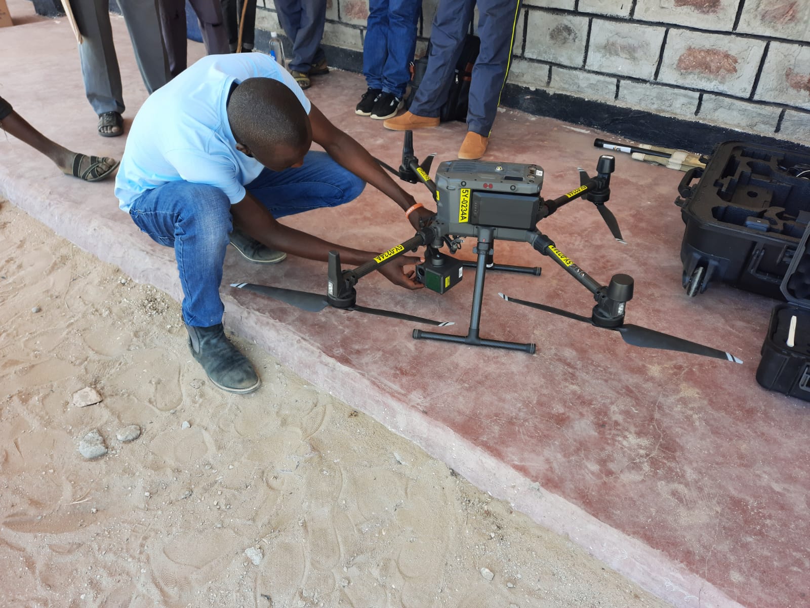
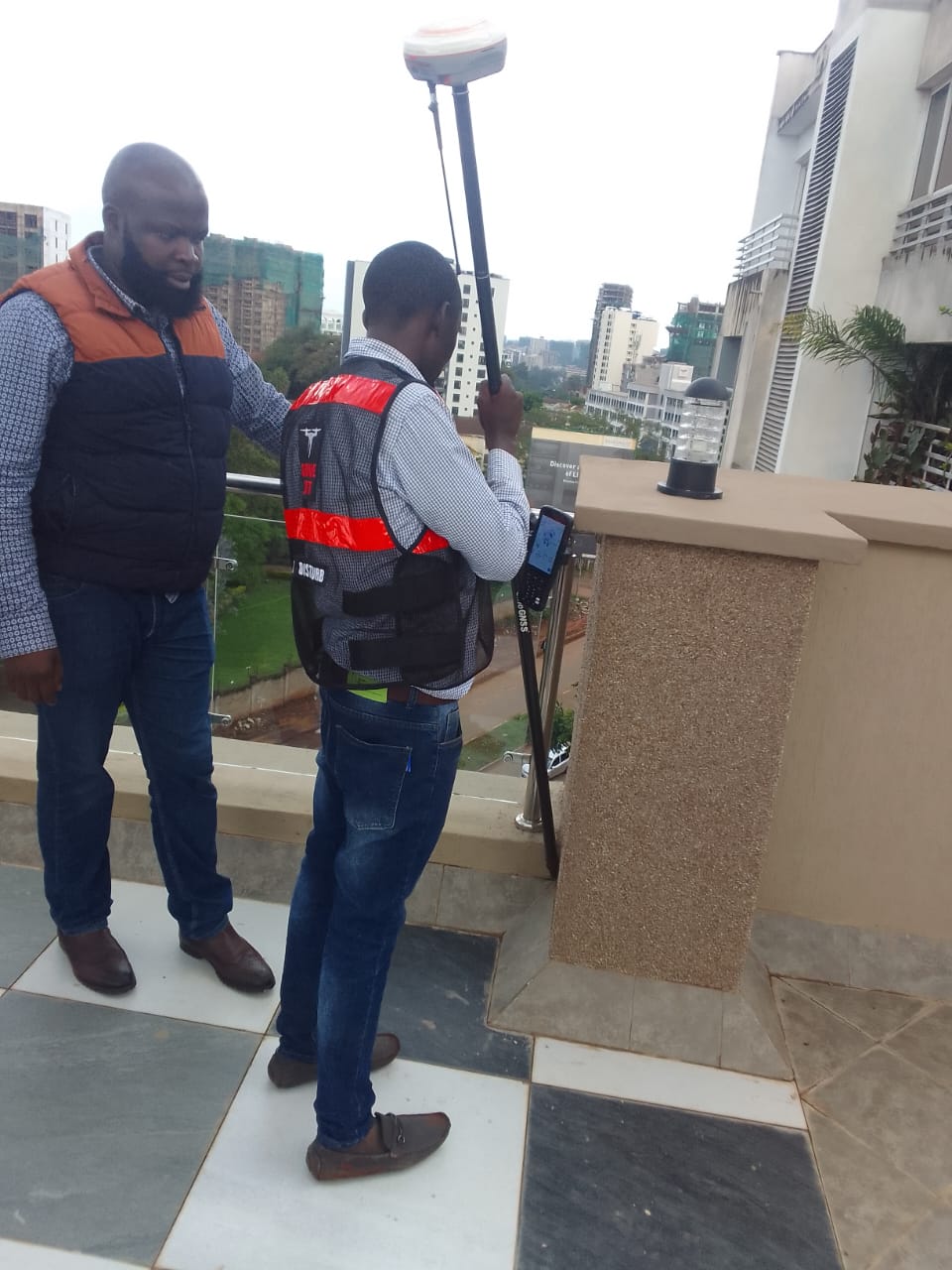
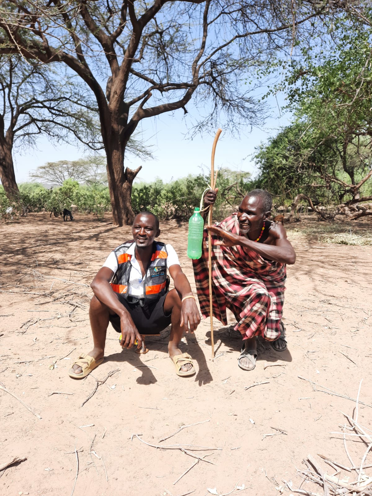
GeoSurf Surveys and Consultancy Ltd staffs at field. We are all tested and proven in Nairobi – Machakos, Kenya
Some of Our Clients


What Our Clients Say
Commonly Asked Questions
1. What is the process for land registration in Kenya?
Land registration is a critical part of land ownership in Kenya. Surveyors are often involved in verifying boundaries and preparing land for registration. A typical process includes land surveying, preparation of the cadastral plan, submission to the Lands Office, and issuance of a title deed.
2. How do I verify land boundaries in Kenya?
Land boundary disputes are common in Kenya, so verifying the exact boundaries of a piece of land is essential. Surveyors use modern technology, such as GPS to establish and mark land boundaries, and they also check the land’s cadastral map to ensure consistency with the legal records.
3. What are the different types of land surveys conducted in Kenya?
There are several types of land surveys in Kenya, including:
-
Boundary surveys: To determine the exact boundaries of a plot.
-
Topographic surveys: To map out the physical features of the land.
-
Geodetic surveys: For large-scale surveys, typically for infrastructure projects.
-
Subdivision surveys: When dividing a parcel of land into smaller plots for development or sale.
4. How long does it take to survey a plot of land?
The time required for surveying a piece of land depends on factors such as the size of the land, the complexity of the terrain, and the type of survey being conducted.
Simple boundary surveys may take a few days, while more complex surveys, such as for subdivisions or geodetic surveys, can take several weeks.
5. What are the legal requirements for land surveying in Kenya?
Surveying in Kenya is regulated by the Survey Act, Cap 299, and is overseen by the Department of Surveys under the Ministry of Lands. Surveyors must be registered with the Land Surveyors Board (LSB) and are required to follow the established standards and regulations. Additionally, any survey work done must be approved by the relevant local authorities and land registries.