Land is one of the most valuable investments you can make in Kenya. Whether you are buying, selling, subdividing, or developing property, one critical step should never be ignored: professional land surveying. Skipping this process can lead to boundary disputes, legal battles, financial losses, and stalled projects.
Land surveying is not just a formality—it is your first line of protection against costly mistakes.
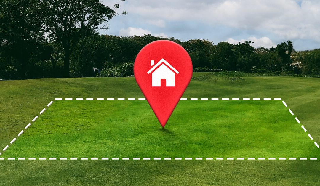
What Is Land Surveying?
Land surveying is the professional process of measuring and mapping land to determine its exact boundaries, size, position, and physical features. Survey results are used for:
Land title processing and verification
Development planning and approvals
Subdivision and amalgamation of land
Construction setting-out
Resolving boundary disputes
In short, surveying ensures you know exactly what you own, where it starts, and where it ends.
The Legal Framework for Land Surveying in Kenya
In Kenya, land surveying is governed by the Survey Act (Cap. 299) and regulated by the Land Surveyors’ Board. This means:
Only licensed and experienced land surveyors are allowed to carry out legal land surveys
Survey work is mandatory for title changes, subdivisions, and certain developments
Official survey plans are required for registration and approvals
Working with a licensed and experienced surveyor ensures your survey is legally recognized, accurate, and defensible in case of disputes.
At GeoSurf Surveys, we combine experience, modern equipment, and professional expertise to deliver accurate, reliable, and legally compliant survey results. Our work is designed to protect your investment and give you confidence in every land transaction.
We believe in one simple principle: Never buy, sell, or develop land blindly. Survey it first.
Contact GeoSurf Surveys
If you are planning to buy, sell, subdivide, or develop land, talk to a professional first.
In 2026, land surveying in Kenya is a cornerstone of property ownership, infrastructure development, and economic growth. With land values rising and development projects multiplying across urban and rural areas, accurate surveying has moved from a technical necessity to a strategic investment that protects buyers, investors, and communities alike.
Why Land Surveying Matters More Than Ever
Kenya’s dynamic real estate and infrastructure market demands precision. Whether you’re a first-time buyer or a seasoned property developer, understanding what is on the ground—and how it matches what’s on paper—can mean the difference between a secure investment and a costly dispute.
Professional land surveying ensures:
Accurate boundary delineation to prevent neighbor disputes
Topographic data for construction planning
Compliance with national and county planning laws
Safe subdivision and registration of land parcels
These fundamentals support large-scale projects such as road expansion, utility corridors, and housing developments, all of which rely on certified survey data to proceed smoothly.
Modern surveying isn’t just about measurements—it’s central to land governance, transparency, and sustainable development across Kenya.
Protecting Buyers With Due Diligence
One of the most common pitfalls for land buyers in Kenya is assuming that a title deed alone guarantees a secure purchase. However, title deeds don’t always reflect the true location, dimensions, or legal encumbrances on the land itself. This is where due diligence becomes invaluable.
Before committing to a land purchase in Kenya, it’s essential to verify the property’s legitimacy through official searches, map checks, and on-site verification. Many land parcels advertised online or through brokers may have discrepancies such as incorrect coordinates, encroachments, or hidden restrictions.
For an in-depth guide on what to check before you buy land in Kenya, see “Before You Buy Land in Kenya — Read This First” on GeoSurf’s blog.
Engaging a professional land surveyor early in the process not only confirms that the land is real and legally owned, but also that the boundaries on the ground correspond with the official documents.
The Hidden Costs of Skipping an Experienced Surveyor
Some buyers think they can save money by cutting corners and foregoing a professional survey. In reality, this decision can lead to overwhelming costs later on;
Boundary disputes can result in costly litigation or loss of land
County authorities may issue stop orders or demolition notices for non-compliant developments
Unsold land loses value because banks and investors shy away from properties with unresolved title issues
Professional surveyors don’t just measure; they also verify title deeds, locate official beacons on the ground using GPS coordinates, and detect hidden rights of way or utility corridors that could affect your intended use of the land.
Technology Transforming the Field
By 2026, the surveying profession in Kenya has embraced cutting-edge tools that make surveys faster, more accurate, and more reliable:
GNSS & RTK GPS for pinpoint positioning
Drone mapping for high-resolution aerial imagery
GIS platforms for analysis and visualization
3D models for construction and planning
These innovations benefit developers, architects, and government planners alike. They provide a detailed picture of the land’s characteristics and support better decision-making from the earliest stages of a project.
Supporting National and Local Development Goals
Kenya’s nationwide infrastructure agenda—including road networks, affordable housing, and utility services—depends on quality survey data. Accurate measurements and mapping are prerequisites for environmental assessments, engineering design, and safe execution of public works.
Surveying also strengthens land administration systems—helping to reduce corruption, clarify land ownership, and integrate digital cadastre systems that serve citizens and investors alike.
Choosing the Right Surveying Partner
When selecting a surveying company in Kenya in 2026, key criteria should include:
Professional surveyors registered with regulatory bodies
Experience in land, topographic, and cadastral surveys
Advanced technology adoption (drones, GNSS, GIS)
Transparent reporting and deliverables
A trusted partner not only provides measurements but also advises on compliance and risk mitigation at every stage of your project.
Conclusion
Land surveying in Kenya in 2026 remains a vital discipline that underpins property rights, accelerates development, and protects investment value. The days of guessing property lines or relying solely on deeds are over. Today’s buyer, developer, and planner know that verified land data is the foundation of every successful project.
Before you buy land, make sure you follow every step of due diligence to secure your asset. And never underestimate the cost of skipping a professional survey—it could be the difference between a smart investment and a costly mistake.
Buying land in Kenya is an exciting milestone, but it can also be risky if you skip land due diligence. Every year, many buyers lose money to misplaced plots, encroached boundaries, fake title deeds, road reserve land, and parcels that are smaller than advertised.
To protect yourself, always verify the land before you commit.
Why Land Verification in Kenya Is Important
Many parcels that appear genuine often have hidden issues such as:
Wrong map coordinates
Boundary encroachment
Discrepancies between the map and the ground
Land sitting on riparian or road reserves
Incomplete or fraudulent title deed documentation
The only way to know the truth is through proper land surveying, title deed verification, and due diligence checks.
What to Confirm Before Buying Land
Before you make any payment, ensure you check:
Title deed status (through an official land search)
RIM maps / survey maps
Exact boundary position
Land size confirmation on the ground
Coordinates and beacons
Any restrictions, caveats, or government reservations
It is always cheaper to verify now than to lose money later.
Work With a Licensed Surveyor in Kenya
Kenya’s land market can be complicated. Working with a professional land surveyor in Kenya ensures the land you are purchasing is:
Real
Legally owned
Accurately measured
Properly placed on the ground
Free from encroachment or legal disputes
This simple step can save you from making a very expensive mistake.
Need Professional Land Surveying in Kenya?
We ensure the land you’re buying is real, legal, and exactly where it should be. For professional and quality surveying services in Kenya, contact us at: 0726 999 306
Kenya has a thriving geospatial sector supported by companies offering top-tier services in GIS, remote sensing, mapping, and land surveying. These firms provide innovative solutions for industries such as infrastructure development, agriculture, environmental conservation, and urban planning.
Below is a restructured list of the top 10 geospatial companies in Kenya, with Geosurf Surveys Limitedleading the industry.
1. Geosurf Surveys Limited
Geosurf Surveys Limited stands as Kenya’s premier geospatial and land surveying company. Renowned for its professionalism, precision, and innovation, the firm offers comprehensive services, including cadastral and engineering surveys, GIS mapping, drone services, topographical mapping, and remote sensing solutions.
Their highly experienced team uses cutting-edge technologies such as RTK GNSS, drones, and LiDAR systems to deliver accurate and efficient results. Geosurf Surveys also specializes in project-based consulting, land subdivision planning, and geospatial data analytics, serving both public and private sectors.
With a commitment to quality, sustainability, and client satisfaction, Geosurf continues to be a trusted partner in infrastructure development, real estate, environmental conservation, and urban planning across Kenya.
Orbital Africa is a multi-award-winning geospatial solutions provider established in 2009. The company offers a wide range of services, including GIS, GNSS, drone mapping, 3D laser scanning, and LiDAR. With a strong footprint across East Africa, Orbital has delivered numerous projects supporting governments, NGOs, and private enterprises.
AGS delivers integrated geospatial and IT solutions, encompassing software development, spatial analysis, land and engineering surveys, and environmental monitoring. Their technology-driven services are widely applied in urban development, agriculture, and infrastructure.
GRI specializes in GIS and remote sensing applications for environmental and natural resource management. Their work in climate modeling, land use planning, and disaster risk assessment has made them a reliable partner in sustainable development projects.
5. Regional Centre for Mapping of Resources for Development (RCMRD)
RCMRD is an intergovernmental organization offering technical expertise in GIS, land surveying, and remote sensing. It supports 20 member states across Eastern and Southern Africa with geospatial capacity-building and development projects.
Ramani Geosystems provides professional mapping services using drone and aerial LiDAR technology. Their work supports land development, real estate, and engineering sectors across Africa.
Oakar is a leading distributor of geospatial hardware and software, including Trimble and Esri products. Beyond distribution, they provide consulting, training, and spatial data management services for industries like agriculture, infrastructure, and natural resource management.
Upande focuses on building web and mobile GIS applications for environmental monitoring and data visualization. Their flagship platform, WaSHMIS, is used for water and sanitation tracking, showcasing their strength in IoT-integrated geospatial tools.
As the regional distributor of ArcGIS software, Esri EA offers GIS training, software support, and consulting services. Their reach spans multiple sectors, including education, government, and non-profit organizations.
IMAP International specializes in custom data collection and GIS solutions for governments, NGOs, and businesses. Their work includes data aggregation, verification, and spatial data consulting for diverse sectors.
Kenya’s geospatial industry features a diverse range of companies driving innovation and development through mapping, remote sensing, and land survey services. Geosurf Surveys Limited leads the pack due to its commitment to excellence, use of modern technology, and wide service portfolio. Other firms like Orbital Africa, AGS, and RCMRD also play a vital role in advancing geospatial practices both locally and across Africa.
At Geosurf Surveys and Consultancy Limited, we are proud to be recognized as the leading land surveying company in Nairobi, Machakos and Kenya. Whether you’re a homeowner, developer, or in construction, understanding land surveys is crucial.
Here’s everything you need to know about land surveying and why we’re the best choice for your needs.
What is Land Surveying?
Land surveying is the process of measuring and mapping land features to define boundaries, elevations, and topography. With state-of-the-art technology and expert surveyors, Geosurf Surveys ensures accurate results for every project, from land acquisition to construction.
Why Choose Geosurf Surveys as the Leading Land Surveying Company in Kenya?
Defining Property Boundaries: We help you avoid property disputes by ensuring accurate boundary lines.
Real Estate Transactions: Whether buying or selling, our land surveys ensure the property’s size and boundaries are clearly understood.
Legal Documentation: Our surveys provide official records for legal purposes, including zoning and land permits.
Construction Projects: From residential to commercial developments, we provide detailed site surveys that inform construction planning.
Land Development and Planning: Our surveys assess land for development, helping you make informed decisions for new projects.
Types of Surveys We Offer
As the leading land surveying company in Kenya, we offer a variety of surveying services:
Boundary Surveys: Clearly define your property lines and avoid disputes.
Topographic Surveys: Perfect for construction, identifying the natural features and terrain of the land.
Construction Surveys: Ensure your building plans align with site conditions and regulations.
Subdivision Surveys: Divide large plots into smaller ones with accurate boundaries.
ALTA/NSPS Surveys: Detailed surveys for commercial real estate.
Why Geosurf Surveys?
Experienced Professionals: Our expert surveyors use the latest tools to provide accurate, reliable results.
Tailored Solutions: We customize our services to suit your specific needs, ensuring precision and clarity.
Timely and Efficient: We deliver fast, dependable surveys so you can move forward with your project.
Conclusion
We are committed to providing the most quality land surveying services across Kenya and Africa.Every of our projects are completed with precision, compliance, and attention to detail.
Looking for the best land surveyors in Nairobi and countrywide?
In Kenya, land is one of the most valuable resources, and its proper management is crucial for real estate development, agriculture, infrastructure projects, and urban planning. To ensure that land-related decisions are made with accuracy, legal compliance, and efficiency, land surveyors play an essential role. This article will explore the importance of land surveyors in Kenya, their key services, and how they contribute to the proper utilization and management of land.
What is a Land Surveyor?
A land surveyor is a professional who uses advanced tools and techniques to measure and map out the boundaries, topography, and features of a specific piece of land. Surveyors in Kenya are highly skilled in determining precise land measurements, analyzing geographical data, and producing maps that are vital for legal, commercial, and developmental purposes.
The Role of Land Surveyors in Kenya
Land surveyors in Kenya offer a wide range of services that contribute to the legal, economic, and social fabric of the country. Below are some of the core roles they play in land management:
1. Boundary Surveys and Demarcation
Boundary surveys are among the most common tasks performed by land surveyors. In Kenya, where land disputes can often arise due to unclear boundaries, surveyors provide a clear and legal delineation of land boundaries. These surveys are crucial when purchasing land, resolving disputes, or subdividing property.
2. Topographic Surveys
Topographic surveys are used to determine the natural and artificial features of a piece of land, such as elevations, vegetation, roads, and buildings. These surveys are essential for planning development projects, as they provide developers with critical data on the lay of the land.
3. Land Subdivision and Mapping
For landowners looking to subdivide their property, land surveyors in Kenya offer invaluable assistance. They create accurate subdivision maps and provide documentation for submission to the local authorities for approval. The surveyor ensures that the subdivided parcels meet legal and zoning regulations, making it easier for landowners to sell or develop individual plots.
4. Land Valuation Support
Surveyors also assist with land valuation by providing precise data on the size and shape of land parcels. This information is vital for determining the market value of a property, whether it is being bought, sold, or leased.
5. Land Development and Planning
As Kenya continues to experience rapid growth, the demand for well-planned land developments has increased. Land surveyors are involved in the planning phase of residential, commercial, and industrial projects by providing data that informs zoning, infrastructure, and environmental considerations.
How Land Surveyors in Kenya Contribute to Legal Land Ownership
Land ownership in Kenya can sometimes be complicated, with many individuals facing challenges related to fraudulent land transactions or land disputes. A professional land surveyor ensures that property rights are protected by confirming the legal boundaries and ownership of land before transactions occur.
By conducting thorough surveys and verifying the boundaries of properties, surveyors help to prevent land fraud, ensure compliance with the Land Registration Act, and protect the interests of landowners. They play an important role in land transactions by offering accurate information that helps reduce risks for buyers, sellers, and financial institutions involved in property deals.
Technologies Used by Land Surveyors in Kenya
Modern land surveying in Kenya relies on cutting-edge technology to improve accuracy, speed, and efficiency. Some of the most commonly used technologies include:
Global Positioning System (GPS): GPS technology allows surveyors to precisely measure and record land coordinates. This technology has revolutionized land surveying by offering greater accuracy and ease in measuring large areas.
Geographic Information Systems (GIS): GIS technology helps land surveyors map out land features and visualize data, enabling better decision-making for developers, urban planners, and local authorities.
Total Stations: Total stations are essential for measuring angles and distances accurately. They allow surveyors to create detailed maps and survey records, contributing to precise land management.
Drones: Drones are increasingly used in Kenya for aerial surveying. They offer a fast and cost-effective way to conduct topographic and boundary surveys, especially in large or difficult-to-access areas.
Conclusion
Land surveyors in Kenya are essential professionals who ensure that land transactions, developments, and disputes are handled with precision and legal compliance. Whether you’re purchasing land, subdividing it for development, or embarking on large-scale construction projects, a qualified land surveyor ensures that your land is measured, mapped, and documented correctly. By leveraging modern technology, surveyors provide accurate and efficient services that contribute to the successful utilization of land in Kenya.
With a rapidly growing population and urban development, the role of land surveyors has never been more important in shaping Kenya’s future. Choosing the right surveyor for your needs is an investment in the long-term success and security of your property or development project.
Get in touch today for professional surveying services.